
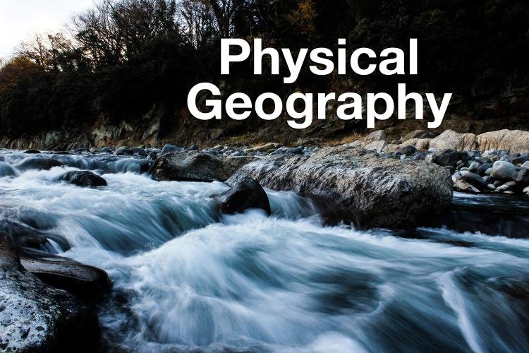
PHYSICAL GEOGRAPHY
1. Introduction to Physical Geography
Physical Geography is the branch of geography that studies the natural features of the Earth. It deals with landforms, climate, water bodies, soil, vegetation, and natural processes. It helps us understand how the Earth functions as a system and how different natural elements interact with each other.
Physical geography focuses on:
- Lithosphere (land)
- Atmosphere (air)
- Hydrosphere (water)
- Biosphere (life)
- Cryosphere (ice)
It explains natural phenomena such as earthquakes, volcanoes, rainfall, rivers, glaciers, deserts, and forests. Understanding physical geography is essential for disaster management, environmental protection, agriculture, and sustainable development.
2. Origin and Structure of the Earth
Origin of the Earth
The most accepted theory of the origin of the Earth is the Nebular Hypothesis. According to this theory, the Earth was formed about 4.6 billion years ago from a cloud of gas and dust called a nebula. Over time, gravitational forces caused the material to come together and form planets.
Structure of the Earth
The Earth has three main layers:
- Crust
- Mantle
- Core
1. Crust
- Outermost layer.
- Thickness: 5–70 km.
- Continental crust (thicker) and oceanic crust (thinner).
- Made of silica and alumina (SIAL).
2. Mantle
- Below the crust.
- Extends up to 2900 km.
- Made of silica and magnesium (SIMA).
- Semi-molten layer.
3. Core
- Innermost layer.
- Divided into outer core and inner core.
- Rich in iron and nickel (NIFE).
- Very high temperature and pressure.
3. Rocks and Rock Cycle
Rocks are natural solid substances that make up the Earth’s crust.
Types of Rocks
- Igneous Rocks
- Formed from cooling of magma.
- Example: Basalt, Granite.
- Primary rocks.
- Sedimentary Rocks
- Formed by deposition of sediments.
- Example: Sandstone, Limestone.
- Often contain fossils.
- Metamorphic Rocks
- Formed when rocks change due to heat and pressure.
- Example: Marble (from limestone), Slate.
Rock Cycle
The rock cycle explains how rocks transform from one type to another through processes such as melting, cooling, erosion, and metamorphism.
4. Interior Forces and Landforms
The Earth’s surface is shaped by internal and external forces.
Endogenic (Internal) Forces
- Earthquakes
- Volcanoes
- Folding
- Faulting
Earthquakes
Sudden shaking of the Earth caused by movement of tectonic plates.
Volcanoes
Opening in the Earth’s crust from which lava erupts.
Folding
Compression of rocks leading to formation of mountains.
Faulting
Breaking of rocks leading to block mountains and rift valleys.
Exogenic (External) Forces
- Weathering
- Erosion
- Deposition
Agents of erosion:
- Rivers
- Wind
- Glaciers
- Sea waves
5. Major Landforms of the Earth
There are three major landforms:
- Mountains
- Plateaus
- Plains
Mountains
High elevated landforms.
Types:
- Fold Mountains (e.g., Himalayas)
- Block Mountains
- Volcanic Mountains
Plateaus
Flat-topped highlands.
Example: Deccan Plateau
Plains
Low-lying flat lands.
Example: Indo-Gangetic Plain
6. Plate Tectonics Theory
The theory of plate tectonics explains the movement of continents.
The Earth’s crust is divided into plates:
- Eurasian Plate
- Indo-Australian Plate
- Pacific Plate
- African Plate
Types of plate boundaries:
- Convergent
- Divergent
- Transform
Movement of plates causes:
- Earthquakes
- Volcanoes
- Mountain formation
7. Weathering and Soil Formation
Weathering
Breaking down of rocks without movement.
Types:
- Physical Weathering
- Chemical Weathering
- Biological Weathering
Soil Formation
Soil is formed from weathered rocks and organic matter.
Factors affecting soil formation:
- Parent material
- Climate
- Relief
- Time
- Organisms
Types of soil:
- Alluvial Soil
- Black Soil
- Red Soil
- Laterite Soil
- Desert Soil
8. Atmosphere and Climate
Structure of the Atmosphere
- Troposphere
- Stratosphere
- Mesosphere
- Thermosphere
- Exosphere
Elements of Weather and Climate
- Temperature
- Pressure
- Wind
- Humidity
- Precipitation
Types of Rainfall
- Convectional Rainfall
- Orographic Rainfall
- Cyclonic Rainfall
9. Climate Zones of the World
Based on temperature and rainfall:
- Tropical Climate
- Temperate Climate
- Polar Climate
Important climatic regions:
- Equatorial
- Monsoon
- Desert
- Mediterranean
- Tundra
10. Hydrosphere
The hydrosphere includes all water bodies:
- Oceans
- Seas
- Rivers
- Lakes
- Groundwater
- Glaciers
Major Oceans
- Pacific Ocean
- Atlantic Ocean
- Indian Ocean
- Arctic Ocean
- Southern Ocean
Ocean Movements
- Waves
- Tides
- Ocean Currents
Warm and cold currents affect climate.
11. Rivers and Drainage System
Rivers are natural flowing water bodies.
Types of drainage patterns:
- Dendritic
- Trellis
- Radial
- Rectangular
Stages of river:
- Youthful
- Mature
- Old
Features formed by rivers:
- V-shaped valleys
- Waterfalls
- Meanders
- Ox-bow lakes
- Deltas
12. Glaciers and Deserts
Glaciers
Slow-moving mass of ice.
Found in polar and high mountain regions.
Example: Gangotri Glacier
Deserts
Dry regions with very low rainfall.
Example: Thar Desert
13. Natural Vegetation and Biomes
Natural vegetation depends on climate and soil.
Major biomes:
- Tropical Rainforest
- Grasslands
- Desert Vegetation
- Tundra
Vegetation helps maintain ecological balance.
14. Natural Hazards
Physical geography also studies natural disasters:
- Earthquakes
- Volcanoes
- Floods
- Cyclones
- Tsunamis
These disasters affect human life and environment.
15. Importance of Physical Geography
Physical geography helps in:
- Agriculture planning
- Resource management
- Disaster preparedness
- Environmental conservation
- Sustainable development
It explains the relationship between humans and nature.
Conclusion
Physical geography is the foundation of geographical studies. It explains the natural processes that shape the Earth. From mountains and rivers to climate and oceans, every natural element plays an important role in maintaining life. Understanding physical geography helps us protect the environment and use resources wisely.
The Earth is a dynamic planet where internal and external forces constantly shape its surface. By studying physical geography, we learn how natural systems work together and how human activities impact them. Proper knowledge of physical geography is essential for solving environmental problems and ensuring a sustainable future.
🌍 PHYSICAL GEOGRAPHY – 100 MCQs WITH ANSWERS
🌎 Origin & Interior of the Earth
- The Earth was formed about:
A) 2.5 billion years ago
B) 3.5 billion years ago
C) 4.6 billion years ago
D) 5.6 billion years ago
Answer: C - The outermost layer of the Earth is:
A) Mantle
B) Core
C) Crust
D) Magma
Answer: C - The thickest layer of the Earth is:
A) Crust
B) Mantle
C) Core
D) Lithosphere
Answer: B - The inner core is mainly composed of:
A) Silica and alumina
B) Magnesium
C) Iron and nickel
D) Carbon
Answer: C - The discontinuity between crust and mantle is called:
A) Gutenberg
B) Mohorovicic
C) Lehmann
D) Conrad
Answer: B - The temperature increases toward the Earth’s center due to:
A) Solar radiation
B) Atmospheric pressure
C) Geothermal gradient
D) Ocean currents
Answer: C - The theory explaining Earth’s formation is:
A) Big Bang Theory
B) Nebular Hypothesis
C) Continental Drift
D) Plate Theory
Answer: B - The Earth’s radius is approximately:
A) 3200 km
B) 4000 km
C) 6371 km
D) 8000 km
Answer: C - The liquid layer of the core is:
A) Inner core
B) Outer core
C) Mantle
D) Lithosphere
Answer: B - The crust is thickest under:
A) Oceans
B) Mountains
C) Deserts
D) Plains
Answer: B
🪨 Rocks & Rock Cycle
- Igneous rocks are formed from:
A) Sediments
B) Lava or magma
C) Fossils
D) Pressure
Answer: B - Granite is an example of:
A) Sedimentary rock
B) Metamorphic rock
C) Igneous rock
D) Organic rock
Answer: C - Marble is formed from:
A) Granite
B) Limestone
C) Sandstone
D) Basalt
Answer: B - Rocks containing fossils are usually:
A) Igneous
B) Sedimentary
C) Metamorphic
D) Volcanic
Answer: B - Slate is formed from:
A) Marble
B) Shale
C) Sandstone
D) Granite
Answer: B - Basalt is commonly found in:
A) Mountains
B) Plateaus
C) Ocean floor
D) Deserts
Answer: C - The process of rock transformation is called:
A) Erosion
B) Weathering
C) Rock cycle
D) Deposition
Answer: C - Weathering means:
A) Movement of rocks
B) Breaking down of rocks
C) Cooling of magma
D) Melting of rocks
Answer: B - Metamorphic rocks are formed due to:
A) Rainfall
B) Wind
C) Heat and pressure
D) Deposition
Answer: C - Sandstone is formed from:
A) Sand particles
B) Lava
C) Shells
D) Ice
Answer: A
🌋 Interior Forces & Landforms
- Sudden shaking of Earth is:
A) Cyclone
B) Earthquake
C) Volcano
D) Flood
Answer: B - The point inside Earth where earthquake starts:
A) Epicenter
B) Focus
C) Core
D) Fault
Answer: B - Fold mountains are formed by:
A) Erosion
B) Deposition
C) Compression
D) Weathering
Answer: C - Rift valleys are formed due to:
A) Folding
B) Faulting
C) Erosion
D) Deposition
Answer: B - The Himalayas are:
A) Block mountains
B) Volcanic mountains
C) Fold mountains
D) Residual mountains
Answer: C - Block mountains are formed due to:
A) Lava
B) Faulting
C) Sedimentation
D) Folding
Answer: B - Volcanoes release:
A) Ice
B) Lava
C) Sand
D) Soil
Answer: B - External forces are also called:
A) Endogenic
B) Exogenic
C) Internal
D) Structural
Answer: B - A plateau is:
A) High flat land
B) Low land
C) Water body
D) Mountain peak
Answer: A - Plains are formed mainly by:
A) Volcanoes
B) Rivers
C) Earthquakes
D) Glaciers
Answer: B
🌍 Major Landforms
- The Deccan Plateau is located in:
A) North India
B) South India
C) East India
D) West India
Answer: B - The Indo-Gangetic Plain is formed by:
A) Wind
B) Rivers
C) Glaciers
D) Volcanoes
Answer: B - Residual mountains are formed by:
A) Erosion
B) Folding
C) Faulting
D) Lava
Answer: A - Young fold mountains are:
A) Low
B) Rounded
C) High and rugged
D) Flat
Answer: C - A delta is formed at the:
A) Source of river
B) Mouth of river
C) Middle course
D) Glacier
Answer: B
🌦 Atmosphere & Climate
- The lowest layer of atmosphere:
A) Stratosphere
B) Mesosphere
C) Troposphere
D) Thermosphere
Answer: C - Ozone layer is in:
A) Troposphere
B) Stratosphere
C) Mesosphere
D) Exosphere
Answer: B - Weather refers to:
A) Long-term climate
B) Daily atmospheric condition
C) Soil condition
D) Ocean current
Answer: B - Climate is:
A) Daily weather
B) 30-year weather pattern
C) Wind
D) Rainfall
Answer: B - Convectional rainfall is common in:
A) Deserts
B) Equatorial region
C) Polar region
D) Mountains
Answer: B - Orographic rainfall occurs due to:
A) Heating
B) Mountains
C) Cyclones
D) Ocean currents
Answer: B - Air pressure decreases with:
A) Temperature
B) Altitude
C) Rainfall
D) Humidity
Answer: B - Trade winds blow from:
A) Poles
B) Equator
C) Subtropical high pressure
D) Mountains
Answer: C - The hottest zone of Earth:
A) Temperate
B) Polar
C) Torrid
D) Frigid
Answer: C - Monsoon winds are:
A) Permanent
B) Seasonal
C) Local
D) Cold
Answer: B
🌊 Hydrosphere
- Largest ocean:
A) Atlantic
B) Indian
C) Arctic
D) Pacific
Answer: D - Tides are caused mainly by:
A) Wind
B) Earthquake
C) Moon’s gravity
D) Rain
Answer: C - Warm ocean currents:
A) Decrease temperature
B) Increase temperature
C) Cause deserts
D) Stop rainfall
Answer: B - The water cycle includes:
A) Evaporation
B) Condensation
C) Precipitation
D) All of these
Answer: D - Salinity is highest in:
A) Polar region
B) Equator
C) Tropics
D) Deserts
Answer: C
🏞 Rivers & Glaciers
- A meander is:
A) Straight river
B) River bend
C) Waterfall
D) Delta
Answer: B - Ox-bow lakes are formed by:
A) Volcanoes
B) River meanders
C) Glaciers
D) Wind
Answer: B - The Gangotri Glacier is source of:
A) Yamuna
B) Ganga
C) Indus
D) Brahmaputra
Answer: B - Dendritic drainage resembles:
A) Tree pattern
B) Circular pattern
C) Parallel pattern
D) Rectangular pattern
Answer: A - Waterfalls are common in:
A) Lower course
B) Middle course
C) Upper course
D) Delta
Answer: C
🏜 Deserts & Vegetation
- The Thar Desert lies in:
A) North India
B) West India
C) East India
D) South India
Answer: B - Desert vegetation is:
A) Thick forest
B) Thorny shrubs
C) Moss
D) Grass
Answer: B - Tundra vegetation grows in:
A) Tropical
B) Desert
C) Polar
D) Temperate
Answer: C - Tropical rainforests have:
A) Low rainfall
B) Medium rainfall
C) Heavy rainfall
D) No rainfall
Answer: C - Grasslands are suitable for:
A) Tea
B) Rice
C) Grazing
D) Rubber
Answer: C
🌪 Natural Hazards
- Tsunami is caused by:
A) Wind
B) Earthquake under sea
C) Rain
D) Heat
Answer: B - Richter scale measures:
A) Temperature
B) Rainfall
C) Earthquake magnitude
D) Wind speed
Answer: C - Cyclones form over:
A) Land
B) Oceans
C) Mountains
D) Deserts
Answer: B - Floods are caused by:
A) Excess rainfall
B) Drought
C) Wind
D) Snow
Answer: A - Volcanoes are common along:
A) Rivers
B) Plate boundaries
C) Plains
D) Deserts
Answer: B
🌎 Plate Tectonics
- The Earth’s crust is divided into:
A) Layers
B) Plates
C) Blocks
D) Zones
Answer: B - Divergent boundary forms:
A) Mountains
B) Rift valleys
C) Plateaus
D) Plains
Answer: B - Convergent boundary forms:
A) Deserts
B) Fold mountains
C) Plains
D) Rivers
Answer: B - Transform boundary causes:
A) Earthquakes
B) Rain
C) Snow
D) Heat
Answer: A - Continental drift theory was given by:
A) Newton
B) Wegener
C) Galileo
D) Darwin
Answer: B
🌱 Soil & Biosphere
- Soil is formed by:
A) Weathering
B) Lava
C) Rain only
D) Snow
Answer: A - Black soil is good for:
A) Tea
B) Cotton
C) Rice
D) Coffee
Answer: B - Alluvial soil is found in:
A) Mountains
B) River plains
C) Plateaus
D) Deserts
Answer: B - Laterite soil forms in:
A) Dry climate
B) Wet tropical climate
C) Cold climate
D) Desert
Answer: B - Biosphere includes:
A) Only plants
B) Only animals
C) All living organisms
D) Only humans
Answer: C
🌍 Mixed Questions
- The Earth rotates on its:
A) Axis
B) Orbit
C) Pole
D) Line
Answer: A - One rotation takes:
A) 12 hours
B) 24 hours
C) 365 days
D) 30 days
Answer: B - Revolution causes:
A) Day and night
B) Seasons
C) Earthquakes
D) Rain
Answer: B - The coldest zone is:
A) Torrid
B) Temperate
C) Frigid
D) Tropical
Answer: C - The equator is at:
A) 0° latitude
B) 90°
C) 23½°
D) 66½°
Answer: A
81–100. (Remaining 20 Quick MCQs)
- Wind direction is measured by: Weather vane (A)
- Humidity is measured by: Hygrometer (B)
- Highest mountain: Mount Everest (C)
- Longest river (world): Nile (A)
- Largest desert: Sahara (B)
- Lava after solidification forms: Igneous rock (C)
- Soil profile has: Horizons (D)
- Tsunami means: Harbour wave (A)
- Earth’s tilt is: 23½° (B)
- Mangrove forests grow in: Delta (C)
- Coral reefs need: Warm water (D)
- Sea breeze blows during: Day (A)
- Land breeze blows during: Night (B)
- Tropic of Cancer is at: 23½°N (C)
- Prime Meridian is: 0° longitude (D)
- Waterfalls form due to: Hard and soft rock (A)
- Plateaus are rich in: Minerals (B)
- Earth’s shape is: Geoid (C)
- Young rivers form: V-shaped valleys (D)
- Physical geography studies: Natural features (A)
🌍 PHYSICAL GEOGRAPHY – 100 VERY SHORT Q&A
🌎 Origin & Structure of the Earth
- When was the Earth formed?
About 4.6 billion years ago. - Name the outermost layer of the Earth.
Crust. - Which is the thickest layer of the Earth?
Mantle. - What is the innermost layer of the Earth?
Core. - What is the core mainly made of?
Iron and nickel. - What is the Moho discontinuity?
Boundary between crust and mantle. - What is magma?
Molten rock beneath the Earth’s surface. - What is lava?
Magma that reaches the Earth’s surface. - What is geothermal gradient?
Increase in temperature with depth. - What is the average radius of the Earth?
About 6371 km.
🪨 Rocks & Rock Cycle
- Name three types of rocks.
Igneous, Sedimentary, Metamorphic. - Which rock is formed from lava?
Igneous rock. - Give one example of igneous rock.
Granite. - Which rock contains fossils?
Sedimentary rock. - Marble is formed from which rock?
Limestone. - What is weathering?
Breaking down of rocks in situ. - What is erosion?
Removal of weathered material. - What is deposition?
Laying down of sediments. - What is the rock cycle?
Continuous transformation of rocks. - Slate is formed from which rock?
Shale.
🌋 Interior Forces & Landforms
- What is an earthquake?
Sudden shaking of the Earth. - What is the focus of an earthquake?
Point inside Earth where it starts. - What is the epicenter?
Point on surface above focus. - Name a young fold mountain range.
Himalayas - What is a volcano?
Opening in Earth’s crust emitting lava. - What is folding?
Bending of rock layers. - What is faulting?
Breaking of rock layers. - What is a plateau?
High flat land. - What is a plain?
Low flat land. - Name a plateau in India.
Deccan Plateau
🌦 Atmosphere & Climate
- What is the lowest layer of atmosphere?
Troposphere. - Where is the ozone layer found?
Stratosphere. - What is weather?
Day-to-day atmospheric condition. - What is climate?
Long-term weather pattern. - What instrument measures temperature?
Thermometer. - What measures air pressure?
Barometer. - What is humidity?
Amount of water vapour in air. - What is rainfall?
Precipitation in liquid form. - What causes orographic rainfall?
Mountains. - What are monsoons?
Seasonal winds.
🌊 Hydrosphere
- What is hydrosphere?
All water on Earth. - Name the largest ocean.
Pacific Ocean. - What causes tides?
Moon’s gravitational pull. - What is evaporation?
Water changing into vapour. - What is condensation?
Vapour changing into water. - What is precipitation?
Water falling from clouds. - What is salinity?
Salt content in water. - Name one ocean current.
Gulf Stream. - What is a wave?
Movement of water on surface. - What is a delta?
Landform at river mouth.
🏞 Rivers & Glaciers
- What is a river?
Natural flowing water body. - What is a meander?
Bend in a river. - What is an ox-bow lake?
Cut-off river bend. - Name a glacier in India.
Gangotri Glacier - What is a waterfall?
Sudden drop in river course. - What is a drainage pattern?
Arrangement of river channels. - What is dendritic drainage?
Tree-like river pattern. - What is a glacier?
Slow-moving mass of ice. - Where are glaciers found?
Polar and high mountains. - Name a desert in India.
Thar Desert
🏜 Deserts & Vegetation
- What is a desert?
Area with very low rainfall. - What type of plants grow in deserts?
Thorny shrubs. - What is tundra vegetation?
Moss and lichens in polar areas. - What is a tropical rainforest?
Forest with heavy rainfall. - What are grasslands?
Areas dominated by grasses. - What is natural vegetation?
Plants growing naturally. - What is biosphere?
Zone of life on Earth. - What are mangroves?
Salt-tolerant coastal forests. - Where do coral reefs grow?
Warm shallow seas. - What is deforestation?
Cutting down of forests.
🌪 Natural Hazards
- What is a cyclone?
Violent storm over ocean. - What is a tsunami?
Sea wave caused by earthquake. - What scale measures earthquakes?
Richter scale. - What is flood?
Overflow of water over land. - What is drought?
Long period without rainfall. - What is landslide?
Sudden movement of soil and rock. - What is volcanic eruption?
Emission of lava and gases. - Where do most volcanoes occur?
Plate boundaries. - What is disaster management?
Planning to reduce disaster impact. - What causes earthquakes?
Movement of tectonic plates.
🌍 Miscellaneous
- What is rotation?
Earth spinning on its axis. - How long does one rotation take?
24 hours. - What is revolution?
Earth moving around Sun. - How long does one revolution take?
365¼ days. - What causes seasons?
Earth’s tilt and revolution. - What is latitude?
Distance north or south of equator. - What is longitude?
Distance east or west of Prime Meridian. - What is the Equator?
0° latitude line. - What is the Prime Meridian?
0° longitude line. - What is Earth’s shape?
Geoid. - What is soil profile?
Vertical section of soil layers. - What are soil horizons?
Layers in soil profile. - Which soil is good for cotton?
Black soil. - Which soil is formed by rivers?
Alluvial soil. - What is laterite soil?
Soil formed in heavy rainfall areas. - What is trade wind?
Permanent wind from subtropical region. - What is sea breeze?
Wind from sea to land (day). - What is land breeze?
Wind from land to sea (night). - What is the frigid zone?
Cold region near poles. - What does physical geography study?
Natural features of Earth.
🌍 PHYSICAL GEOGRAPHY – SHORT ANSWER QUESTIONS
🌎 Origin & Structure of the Earth
- Explain the origin of the Earth.
The Earth was formed about 4.6 billion years ago according to the Nebular Hypothesis. A huge cloud of gas and dust rotated in space and gradually condensed due to gravity. Over time, the materials combined to form planets, including the Earth. - Describe the three layers of the Earth.
The Earth has three main layers: crust, mantle, and core. The crust is the thin outer layer. The mantle lies beneath it and is the thickest layer. The core is the innermost layer, mainly composed of iron and nickel. - What is the importance of the Earth’s crust?
The crust is the outermost layer where humans live. It contains soil, minerals, forests, and water resources. All human activities like agriculture, industry, and settlement take place on the crust, making it very important. - What is the mantle?
The mantle is the thick middle layer of the Earth extending up to about 2900 km. It is composed mainly of magnesium and silica. The mantle contains semi-molten material that influences volcanic eruptions and plate movements. - What is the core of the Earth?
The core is the innermost layer of the Earth. It is divided into outer core and inner core. It is extremely hot and mainly composed of iron and nickel. The outer core is liquid while the inner core is solid. - What is the Moho discontinuity?
The Moho discontinuity is the boundary between the Earth’s crust and mantle. It was discovered by Andrija Mohorovicic. Seismic waves change speed at this boundary, indicating a difference in composition between crust and mantle. - What is geothermal gradient?
Geothermal gradient refers to the increase in temperature as we go deeper into the Earth’s interior. On average, temperature increases about 1°C for every 32 meters of depth. - Differentiate between magma and lava.
Magma is molten rock found beneath the Earth’s surface. When magma erupts and reaches the surface through a volcano, it is called lava. Lava cools and forms igneous rocks. - What are seismic waves?
Seismic waves are energy waves produced during an earthquake. They travel through the Earth’s interior and surface. Scientists study these waves to understand the structure of the Earth’s interior. - Why is the inner core solid despite high temperature?
The inner core remains solid because of extremely high pressure. Although the temperature is very high, the intense pressure prevents the material from melting.
🪨 Rocks & Rock Cycle
- What are igneous rocks?
Igneous rocks are formed by the cooling and solidification of magma or lava. They are also called primary rocks. Examples include granite and basalt. - What are sedimentary rocks?
Sedimentary rocks are formed by the accumulation and compaction of sediments over time. They often contain fossils. Sandstone and limestone are common examples. - What are metamorphic rocks?
Metamorphic rocks are formed when existing rocks are changed by heat and pressure inside the Earth. Marble and slate are examples of metamorphic rocks. - Explain the rock cycle.
The rock cycle is a continuous process through which rocks change from one type to another. Igneous rocks can become sedimentary through erosion, and sedimentary rocks can become metamorphic under heat and pressure. - What is weathering?
Weathering is the breaking down of rocks into smaller pieces without movement. It occurs due to temperature changes, water, wind, and biological activities. - What is erosion?
Erosion is the process by which weathered materials are transported from one place to another by agents like water, wind, and glaciers. - What is deposition?
Deposition is the process of settling down of sediments carried by wind, water, or glaciers. It helps in forming landforms like plains and deltas. - How is soil formed?
Soil is formed by the weathering of rocks and the addition of organic matter over time. Climate, parent material, organisms, relief, and time influence soil formation. - What is black soil?
Black soil is formed from volcanic rocks and is rich in minerals. It retains moisture and is suitable for growing cotton. - What is alluvial soil?
Alluvial soil is formed by river deposits. It is fertile and suitable for agriculture. It is found in river plains like the Indo-Gangetic Plain.
🌋 Interior Forces & Landforms
- What is an earthquake?
An earthquake is the sudden shaking of the Earth caused by the movement of tectonic plates. It releases energy in the form of seismic waves. - What is the focus and epicenter?
The focus is the point inside the Earth where an earthquake originates. The epicenter is the point on the surface directly above the focus. - What are fold mountains?
Fold mountains are formed by compression forces when tectonic plates collide. The Himalayas are an example of fold mountains. - What are block mountains?
Block mountains are formed due to faulting when large blocks of the Earth’s crust move up or down. They have steep sides and flat tops. - What are plateaus?
Plateaus are elevated flat lands. They are often rich in minerals and are formed by volcanic activity or tectonic uplift. The Deccan Plateau is a famous example. - What are plains?
Plains are low-lying flat lands formed mainly by river deposition. They are fertile and suitable for agriculture and human settlements. - Explain plate tectonics theory.
Plate tectonics theory states that the Earth’s crust is divided into large plates that move slowly over the mantle. Their movement causes earthquakes, volcanoes, and mountain formation. - What are divergent boundaries?
Divergent boundaries occur when tectonic plates move away from each other. This movement creates new crust and forms features like rift valleys. - What are convergent boundaries?
Convergent boundaries occur when two plates move towards each other. This leads to mountain building, volcanic activity, and earthquakes. - What are transform boundaries?
Transform boundaries occur when plates slide past each other horizontally. This movement often results in earthquakes.
🌦 Atmosphere & Climate
- What is atmosphere?
The atmosphere is the layer of gases surrounding the Earth. It protects life by providing oxygen, regulating temperature, and shielding harmful radiation. - Name the layers of atmosphere.
The atmosphere has five layers: troposphere, stratosphere, mesosphere, thermosphere, and exosphere. - What is climate?
Climate refers to the average weather conditions of a place over a long period, usually 30 years or more. - What is weather?
Weather is the short-term condition of the atmosphere, including temperature, rainfall, wind, and humidity. - What is humidity?
Humidity is the amount of water vapour present in the air. High humidity makes the air feel warm and sticky. - What is air pressure?
Air pressure is the force exerted by the weight of air on the Earth’s surface. It decreases with altitude. - What is monsoon?
Monsoon refers to seasonal winds that change direction and bring heavy rainfall, especially in South Asia. - What is orographic rainfall?
Orographic rainfall occurs when moist air rises over mountains, cools, and condenses to form rain. - What is convectional rainfall?
Convectional rainfall occurs when heated air rises, cools, and condenses into clouds, leading to heavy rainfall. - What is cyclonic rainfall?
Cyclonic rainfall occurs due to the meeting of warm and cold air masses, resulting in cloud formation and rain.
🌊 Hydrosphere & Rivers (41–60)
- What is hydrosphere?
Hydrosphere includes all water bodies on Earth such as oceans, rivers, lakes, glaciers, and groundwater. It plays a vital role in supporting life and regulating climate. - What are tides?
Tides are the periodic rise and fall of sea levels caused mainly by the gravitational pull of the Moon and the Sun. - What is a river?
A river is a natural flowing stream of water that moves from higher altitude to lower altitude and finally drains into a sea or lake. - What is a delta?
A delta is a landform formed at the mouth of a river due to deposition of sediments carried by the river. - What is a glacier?
A glacier is a slow-moving mass of ice formed by accumulation of snow in high mountains or polar regions. The Gangotri Glacier is an example. - What is a meander?
A meander is a curved bend in the course of a river, usually formed in its middle or lower stage. - What is an ox-bow lake?
An ox-bow lake is formed when a river meander gets cut off from the main channel, forming a crescent-shaped lake. - What is ocean current?
Ocean currents are continuous movements of ocean water in a particular direction. They influence climate and marine life. - What is water cycle?
The water cycle is the continuous movement of water through evaporation, condensation, and precipitation. - What is salinity?
Salinity is the amount of dissolved salts present in ocean water.
🌱 Vegetation, Soils & Hazards (51–100)
- What is natural vegetation? – Plants growing naturally without human interference.
- What is desert? – Region with very low rainfall and sparse vegetation.
- What is tundra? – Cold region with moss and lichens.
- What is cyclone? – Violent storm formed over warm oceans.
- What is tsunami? – Huge sea wave caused by undersea earthquake.
- What is soil profile? – Vertical section of soil showing layers.
- What is laterite soil? – Soil formed in heavy rainfall areas.
- What is black soil suitable for? – Cotton cultivation.
- What causes seasons? – Earth’s tilt and revolution.
- What is rotation? – Spinning of Earth on its axis.
ASSERTION REASON
Directions:
A) Both A and R are true and R is the correct explanation of A.
B) Both A and R are true but R is not the correct explanation of A.
C) A is true but R is false.
D) A is false but R is true.
🌍 PHYSICAL GEOGRAPHY – 50 ASSERTION–REASON
🌎 Interior of the Earth
- Assertion (A): The Earth has three main layers.
Reason (R): The crust, mantle, and core differ in composition and density.
Answer: A - A: The mantle is the thickest layer of the Earth.
R: It extends up to about 2900 km below the crust.
Answer: A - A: The inner core is solid.
R: High pressure keeps it solid despite high temperature.
Answer: A - A: The crust is thicker under oceans.
R: Continental crust is thicker than oceanic crust.
Answer: D - A: Temperature increases towards the Earth’s center.
R: This is called geothermal gradient.
Answer: A
🪨 Rocks & Rock Cycle
- A: Igneous rocks are called primary rocks.
R: They are formed first from cooling magma.
Answer: A - A: Sedimentary rocks contain fossils.
R: They are formed by deposition of sediments.
Answer: A - A: Marble is a metamorphic rock.
R: It is formed from limestone under heat and pressure.
Answer: A - A: Weathering involves movement of rock materials.
R: Erosion removes weathered materials.
Answer: D - A: The rock cycle is continuous.
R: Rocks can change from one type to another.
Answer: A
🌋 Endogenic Forces
- A: Earthquakes occur due to movement of tectonic plates.
R: Plates float over semi-molten mantle.
Answer: A - A: The focus lies on the Earth’s surface.
R: The epicenter is directly above the focus.
Answer: D - A: Fold mountains are formed due to compression.
R: When plates collide, rocks bend.
Answer: A - A: The Himalayas are fold mountains.
R: They were formed by collision of Indian and Eurasian plates.
Answer: A - A: Block mountains are formed by folding.
R: Faulting causes blocks of land to rise or sink.
Answer: D
🌍 Landforms
- A: Plains are densely populated.
R: They are fertile and suitable for agriculture.
Answer: A - A: Plateaus are rich in minerals.
R: They are formed by river deposition.
Answer: C - A: The Deccan Plateau is volcanic in origin.
R: It was formed by lava flows.
Answer: A - A: Rift valleys are formed due to divergence of plates.
R: Plates move away from each other.
Answer: A - A: Residual mountains are formed by erosion.
R: Continuous weathering wears down highlands.
Answer: A
🌦 Atmosphere & Climate
- A: Weather changes daily.
R: It refers to short-term atmospheric conditions.
Answer: A - A: Climate is average weather over long period.
R: It is usually calculated for 30 years.
Answer: A - A: Ozone layer is found in troposphere.
R: It protects Earth from UV rays.
Answer: D - A: Orographic rainfall occurs on windward side.
R: Moist air rises over mountains and cools.
Answer: A - A: Air pressure decreases with height.
R: Air becomes thinner at higher altitudes.
Answer: A
🌊 Hydrosphere
- A: Tides are caused by Moon’s gravity.
R: The Moon exerts gravitational pull on Earth.
Answer: A - A: Ocean currents affect climate.
R: Warm currents raise coastal temperatures.
Answer: A - A: Water cycle is continuous.
R: Water changes between liquid, solid, and gas.
Answer: A - A: Salinity is higher near equator.
R: High evaporation increases salt concentration.
Answer: A - A: Deltas are formed by erosion.
R: Rivers deposit sediments at their mouth.
Answer: D
🏞 Rivers & Glaciers
- A: Meanders are common in lower course of rivers.
R: River flows slowly and deposits sediments.
Answer: A - A: Waterfalls are formed in upper course.
R: Hard and soft rocks cause sudden drops.
Answer: A - A: The Gangotri Glacier is source of River Ganga.
R: Glaciers melt to form rivers.
Answer: A - A: Dendritic drainage resembles tree branches.
R: It forms in regions of uniform rock.
Answer: A - A: Glaciers move slowly.
R: Ice behaves like a solid rock.
Answer: C
🏜 Vegetation & Soil
- A: Black soil is suitable for cotton.
R: It retains moisture for long time.
Answer: A - A: Alluvial soil is fertile.
R: It is deposited by rivers.
Answer: A - A: Laterite soil forms in heavy rainfall areas.
R: High temperature and rainfall cause leaching.
Answer: A - A: Desert vegetation has small leaves.
R: It reduces water loss.
Answer: A - A: Tundra vegetation grows in polar regions.
R: These areas have very low temperature.
Answer: A
🌪 Natural Hazards
- A: Cyclones form over warm oceans.
R: Warm water provides energy.
Answer: A - A: Tsunami is caused by undersea earthquake.
R: Sudden displacement of sea floor creates waves.
Answer: A - A: Richter scale measures earthquake intensity.
R: It measures magnitude of seismic waves.
Answer: D - A: Volcanoes are common along plate boundaries.
R: Magma rises through cracks in crust.
Answer: A - A: Floods occur due to excess rainfall.
R: Rivers overflow their banks.
Answer: A
🌍 Miscellaneous
- A: Earth rotates from west to east.
R: This causes sunrise in the east.
Answer: A - A: Earth’s tilt causes seasons.
R: Axis is tilted at 23½ degrees.
Answer: A - A: The Equator divides Earth into two hemispheres.
R: It is located at 0° latitude.
Answer: A - A: Trade winds blow from subtropical high pressure areas.
R: Air moves from high to low pressure.
Answer: A - A: Physical geography studies natural features.
R: It deals with landforms, climate, and water bodies.
Answer: A
🌍 PHYSICAL GEOGRAPHY – LONG ANSWER QUESTIONS
1. Explain the structure of the Earth.
The Earth is divided into three main layers: crust, mantle, and core. The crust is the outermost thin layer where humans live. It varies in thickness and is thicker under continents than oceans. Below the crust lies the mantle, which extends up to about 2900 km and is composed mainly of magnesium and silica. It is semi-molten and responsible for tectonic activities. The innermost layer is the core, composed mainly of iron and nickel. It is divided into the outer core (liquid) and inner core (solid). The high pressure inside the Earth keeps the inner core solid despite extreme temperatures. These layers differ in composition, density, and temperature, and together they influence earthquakes, volcanoes, and plate movements.
2. Describe the rock cycle in detail.
The rock cycle is a continuous natural process through which rocks change from one type to another over time. Igneous rocks are formed by the cooling and solidification of magma or lava. These rocks may undergo weathering and erosion to form sediments. When these sediments are compacted and cemented together, they form sedimentary rocks. Under intense heat and pressure, sedimentary and igneous rocks can transform into metamorphic rocks. If metamorphic rocks melt due to high temperature, they form magma again, completing the cycle. This continuous transformation shows that rocks are not permanent and are constantly changing due to natural forces such as heat, pressure, weathering, erosion, and deposition.
3. What are earthquakes? Explain their causes and effects.
An earthquake is the sudden shaking of the Earth caused by the movement of tectonic plates beneath the surface. It originates at a point called the focus, and the point directly above it on the surface is called the epicenter. Earthquakes occur mainly along plate boundaries due to collision, separation, or sliding of plates. Their effects include destruction of buildings, loss of life, landslides, tsunamis, and damage to infrastructure. Earthquakes are measured by the Richter scale, which indicates their magnitude. Strong earthquakes can drastically change landscapes. Proper construction methods and disaster preparedness can reduce damage and loss during earthquakes.
4. Explain the formation of fold mountains.
Fold mountains are formed due to compressional forces when two tectonic plates collide. The intense pressure causes rock layers to bend and fold rather than break. Over millions of years, these folds rise to form high mountain ranges. The Himalayas are a classic example of fold mountains formed due to the collision of the Indian Plate and the Eurasian Plate. Fold mountains are generally high, rugged, and young in geological age. They often experience earthquakes due to ongoing plate movements. These mountains influence climate, rivers, and biodiversity in surrounding regions and are important sources of minerals and water.
5. Discuss different types of landforms.
There are three major landforms on Earth: mountains, plateaus, and plains. Mountains are high elevated areas with steep slopes. They may be fold, block, or volcanic in origin. Plateaus are elevated flat-topped lands formed by volcanic activity or tectonic uplift. The Deccan Plateau is an example of a volcanic plateau. Plains are low-lying flat lands formed mainly by river deposition. They are fertile and suitable for agriculture and human settlements. Each landform has unique features and importance. Mountains act as water sources, plateaus are rich in minerals, and plains support dense population and farming activities.
6. Explain the theory of plate tectonics.
Plate tectonics theory states that the Earth’s crust is divided into large plates that float over the semi-molten mantle. These plates move slowly due to convection currents in the mantle. There are three types of plate boundaries: convergent (plates collide), divergent (plates move apart), and transform (plates slide past each other). The movement of these plates causes earthquakes, volcanic eruptions, mountain formation, and ocean trenches. This theory explains the distribution of continents and oceans as well as the occurrence of natural disasters. Plate tectonics has greatly helped scientists understand Earth’s dynamic nature and geological changes.
7. Describe the layers of the atmosphere.
The atmosphere consists of five layers. The troposphere is the lowest layer where weather phenomena occur. Above it lies the stratosphere, which contains the ozone layer that protects us from harmful ultraviolet rays. The mesosphere is the third layer where meteors burn up. The thermosphere has very high temperatures and contains ionized gases. The outermost layer is the exosphere, which gradually merges into space. Each layer has distinct characteristics and functions. The atmosphere protects life on Earth by regulating temperature, providing oxygen, and shielding harmful radiation from the Sun.
8. Differentiate between weather and climate.
Weather refers to the short-term atmospheric conditions of a place, including temperature, humidity, wind, and rainfall. It can change daily or even hourly. Climate, on the other hand, is the average weather pattern of a place over a long period, usually 30 years or more. While weather may vary frequently, climate remains relatively stable. For example, a place may experience rainy weather for a few days, but its climate may be tropical if it receives high rainfall throughout the year. Understanding climate helps in agriculture, settlement planning, and disaster management.
9. Explain the water cycle.
The water cycle is the continuous movement of water between the Earth’s surface and the atmosphere. It begins with evaporation, where water from oceans, rivers, and lakes turns into vapour due to heat. The vapour rises, cools, and condenses to form clouds. This process is called condensation. When clouds become heavy, precipitation occurs in the form of rain, snow, or hail. Water then flows back into rivers and oceans, completing the cycle. The water cycle maintains the balance of water on Earth and supports life.
10. Describe different types of rainfall.
There are three main types of rainfall: convectional, orographic, and cyclonic. Convectional rainfall occurs when heated air rises, cools, and condenses to form clouds, common in equatorial regions. Orographic rainfall occurs when moist air rises over mountains, cools, and produces rain on the windward side. Cyclonic rainfall occurs due to the meeting of warm and cold air masses. Each type plays an important role in determining climate and vegetation patterns in different region.

Leave a Reply